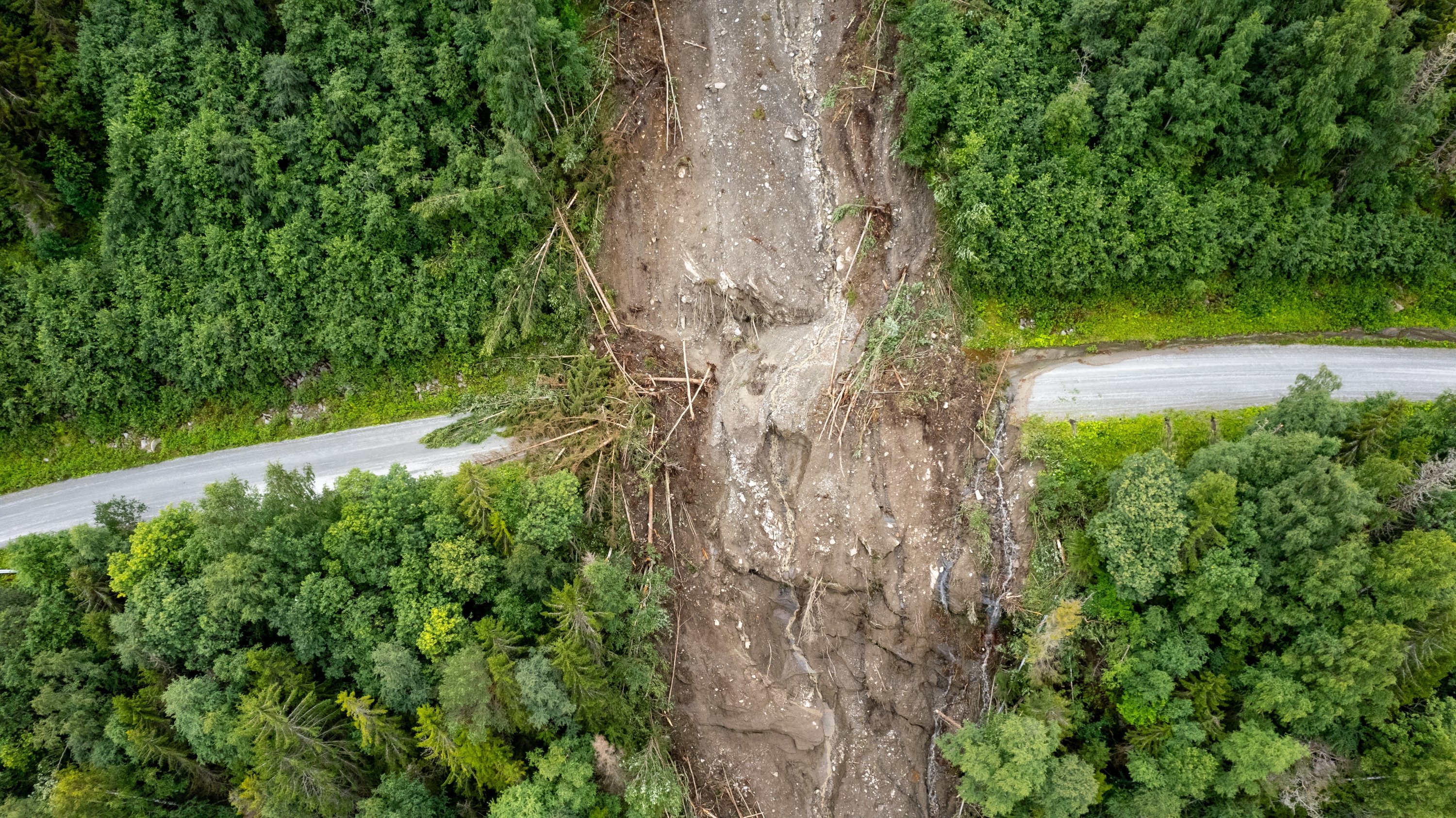
Istanbul Technical University’s (ITU) Eurasia Institute of Earth Sciences and the Disaster and Emergency Management Authority (AFAD) have developed a project that will use an artificial intelligence-powered “Geohazard Monitoring and Risk Analytics Platform” to track geological risks that could affect critical infrastructure and superstructures across the country.
The system, whose pilot implementation has been launched under the “AFAD–ITU National Geohazard Monitoring and Risk Analytics Platform” protocol signed between the ITU Eurasia Institute of Earth Sciences and AFAD, aims to establish a sustainable framework for monitoring, assessing and mitigating geological hazards affecting critical infrastructure and superstructures nationwide.
Professor Tolga Görüm, director of the ITU Eurasia Institute of Earth Sciences, told Anadolu Agency (AA) that the project’s main objective is to establish a Geohazard Monitoring and Risk Analytics Platform at the national level, particularly for critical infrastructure.
The platform was developed for both existing and planned infrastructure and superstructure projects in Türkiye by using remote sensing technologies such as LiDAR and InSAR, he said, “It also seeks to help identify existing risks and ensure that measures to reduce them can be determined and implemented well in advance.”
Görüm noted that the project is being carried out with the support of the Presidency’s Strategy and Budget Directorate and said follow-up projects are also planned as part of the three-year initiative.
He said the platform will monitor from space geological hazards that could affect critical infrastructure such as hospitals, residential areas, tunnels, bridges, railways and highways, including landslides, rockfalls, karst sinkholes and subsidence in alluvial areas caused by changes in groundwater levels.
Explaining that the project will use data obtained from synthetic aperture radar imagery, Görüm said deformation will be analyzed using images collected by ascending and descending satellites at intervals of 12 to 16 days.
Using machine learning and AI technologies, the platform aims to monitor the hazards both spatially and temporally, while providing early warnings to the AFAD and relevant institutions about existing risks.
Görüm said that another goal of the platform is to establish the foundation for early warning systems. “After identifying high-risk areas across Türkiye, field observation and monitoring infrastructure will be installed in those regions so they can be continuously monitored and potential risks identified in advance.”
“As ITU, we are also preparing an application to establish a research center. Through the planned center, public institutions and organizations will be able to access deformation data and geohazard analyses via a web-based interface,” he said.
Reducing future risks
Görüm said the platform will be used not only for new projects but also for existing structures, adding that geohazards such as landslides, rockfalls, sinkholes and subsidence in alluvial areas resulting from geomorphological surface processes will be monitored for both structures in the planning stage and those already in use.
He emphasized that although deformation may not be present today, it could emerge in the future. The system is designed to identify such risks in advance, allowing necessary protective measures to be taken while raising awareness.
“It aims to support both site selection and the safe, sustainable operation of existing locations,” he said.
Görüm stressed that the platform was developed to help predict future risks, noting that existing deformation data will be evaluated together with hydrometeorological indicators.
He said the effects of extreme and cumulative rainfall on landslides will be analyzed using historical data.
“By combining what we have learned from the past with machine learning and the parameters that control these processes, the project seeks to estimate and explain how similar events may occur in areas experiencing similar deformation, ultimately contributing to reducing future risks,” he said.
Pilot phase
Görüm said the project officially entered the implementation stage following the signing of the protocol last week. As part of the pilot phase, the necessary infrastructure has been established, and more than 40 critical sites across Türkiye are now being monitored jointly with AFAD.
He added that AFAD also plans to establish its own observation and warning center focused particularly on landslides, with the system expected to operate through a joint structure.
Landslides are currently being monitored in several regions, including Hakkari, Tortum and Izmir, while AFAD receives regular weekly updates on conditions in these areas.
DAILYSABAH
هلدینگ کاسپین استانبول | خرید ملک در ترکیه | صرافی معتبر ایرانی در ترکیه | خرید و فروش طلا در ترکیه | مهاجرت به ترکیه | واردات و صادرات در ترکیه | نیازمندیهای ترکیه | اخبار ترکیه | اخبار جهانی | توریست ایران | خدمات توریستی در ایران | تورهای گردشگری ایران | هلدینگ اول | خدمات کاریابی و فریلنسری و شغل | مرجع اطلاعات ایران (همه چیز در ایران) | کیف پول و خدمات مالی و پرداخت یار | اخبار ایران | تابلو زنده قیمت ارز در ترکیه و استانبول | صرافی آنلاین ترکیه | قیمت طلا و نقره در ترکیه | سرمایه گذاری در ترکیه | جواهرات در ترکیه | نرخ لحظه ای ارزها در استانبول | قیمت دلار امروز در ترکیه | قیمت دلار استانبول امروز | قیمت لحظه ای دلار | اخبار روز ترکیه استانبول | اپلیکیشن ISTEX | اپلیکیشن قیمت لحظه ای دلار و یورو و لیر و ارزها در ترکیه
About the Author