Tornadoes and flooding are possible this weekend as roller-coaster weather sweeps the country, with some states experiencing summer-like temperatures as high as 90 degrees despite being in the middle of spring.
According to the Storm Prediction Center (SPC), 38 million people between North Texas and Michigan are at risk for severe weather on Friday. The greatest tornado risk will be concentrated in Iowa, Wisconsin, and northern Illinois, where violent storms are expected later today. Cities in the danger zone include Tulsa, Wichita, Madison, Milwaukee, Chicago, Kansas City, Oklahoma City, Des Moines, and St. Louis.
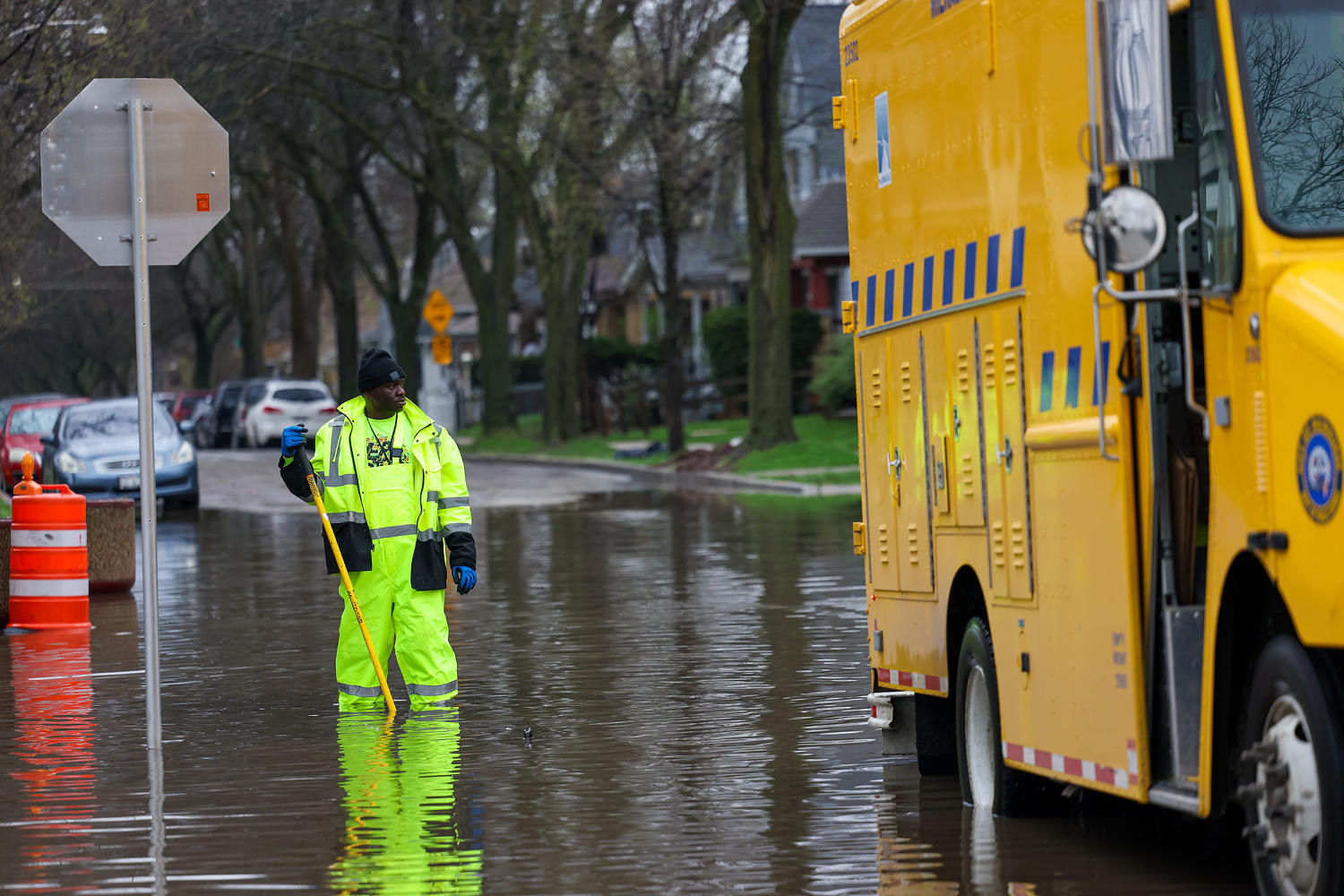
The National Weather Service also warns of flooding from persistent rainfall and thunderstorms across northern Michigan, Wisconsin, western Missouri, and eastern Kansas. Separately, severe thunderstorms are expected to affect roughly 12 million people in the Ohio Valley and eastern Great Lakes region.
The National Weather Service has identified the Upper Mississippi Valley as having the best chance for strong tornadoes, while the greatest hail threat lies over parts of the central and southern Plains.
One resident of Stewartville, Minn. posted video of what appeared to be a tornado outside her office location on Friday.
As storms intensify into the evening hours, a significant damaging wind threat is expected to develop across the Lower Missouri Valley into the Middle Mississippi Valley. Abundant moisture and a approaching upper-level trough are also expected to produce hourly rainfall rates of one to two inches, raising the threat of flash flooding.
In a press release shared on Friday, the Wisconsin Department of Health Services said communities are beginning cleanup efforts despite “more severe weather on the way.” The department is urging residents and crews to remain cautious while assessing damage or removing debris.
In Wisconsin, where floodwaters reached record levels on Wednesday — leaving drivers stranded on inundated highways in Milwaukee — communities are already beginning cleanup efforts. The Wisconsin Department of Health Services cautioned residents and crews to remain vigilant while assessing damage or clearing debris, noting that more severe weather is still on the way.
Milwaukee Mayor Cavalier Johnson described the damage at a Thursday press conference, calling it “an overwhelming force of nature.” Some neighborhoods received a month’s worth of rain in just one to two hours, and the effects of the storms could linger for days.
The National Weather Service’s Washington/Baltimore office has also issued a Red Flag Warning for parts of Virginia’s eastern panhandle and the I-81 corridor, citing low humidity, dry fuels, near-record temperatures, and wind gusts up to 25 mph.
Temperatures are expected to remain well above average across much of the eastern and central U.S. through Friday — reaching the 70s and 80s across the Midwest and the 80s to low 90s in the Southwest — before an approaching cold front brings generally below-average temperatures to the region.
NBC News Top Stories wp:paragraph
هلدینگ کاسپین استانبول | خرید ملک در ترکیه | صرافی معتبر ایرانی در ترکیه | خرید و فروش طلا در ترکیه | مهاجرت به ترکیه | واردات و صادرات در ترکیه | نیازمندیهای ترکیه | اخبار ترکیه | اخبار جهانی | توریست ایران | خدمات توریستی در ایران | تورهای گردشگری ایران | هلدینگ اول | خدمات کاریابی و فریلنسری و شغل | مرجع اطلاعات ایران (همه چیز در ایران) | کیف پول و خدمات مالی و پرداخت یار | اخبار ایران | تابلو زنده قیمت ارز در ترکیه و استانبول | صرافی آنلاین ترکیه | قیمت طلا و نقره در ترکیه | سرمایه گذاری در ترکیه | جواهرات در ترکیه | نرخ لحظه ای ارزها در استانبول | قیمت دلار امروز در ترکیه | قیمت دلار استانبول امروز | قیمت لحظه ای دلار | اخبار روز ترکیه استانبول | اپلیکیشن ISTEX | اپلیکیشن قیمت لحظه ای دلار و یورو و لیر و ارزها در ترکیه